
Okay, let’s talk hurricanes. Not just the scary headlines, but what really matters when NOAA starts talking about these swirling monsters. Here’s the thing: it’s easy to panic when you see that cone of uncertainty plastered all over the news. But that cone? It’s just the tip of the iceberg. What fascinates me is understanding the why behind the forecasts. Why are some hurricanes so devastating, while others fizzle out? Why should you care even if you’re hundreds of miles inland?
Beyond the Cone | Understanding the Real Risks
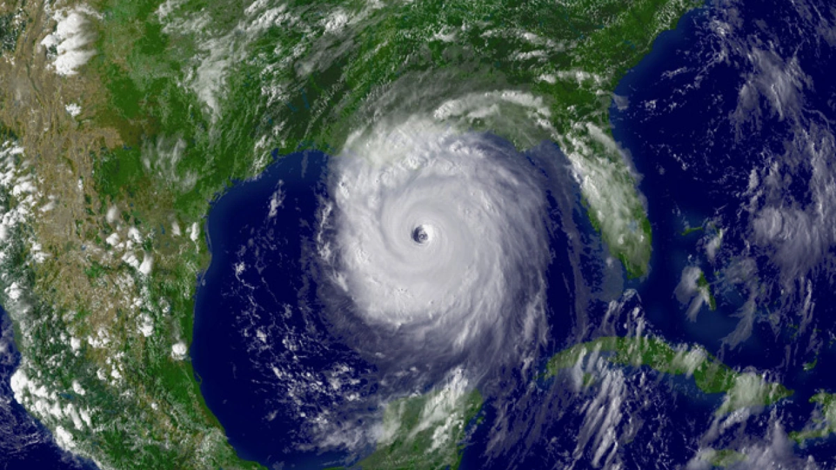
So, you see the cone of uncertainty . What does it actually mean? Well, it represents the probable track of the hurricane’s center . But – and this is a HUGE but – it doesn’t show the size of the storm, the intensity of the winds, or the amount of rainfall. I initially thought everyone understood this, but then I realized how many people focus solely on whether the cone touches their location.
Here’s why that’s a mistake: A hurricane’s impacts can extend hundreds of miles beyond the cone. Think of Hurricane Sandy – it caused devastation far outside its projected path. That’s where understanding NOAA weather models comes in. These models, while not perfect, give us a much more complete picture of potential impacts, including storm surge, inland flooding, and high winds. Learning how to interpret these models – even at a basic level – can be a game-changer for your preparedness.
What’s more, pay attention to official forecasts. These forecasts are continuously updated with the most recent data, so ensure you are getting your information from reputable sources.
Why Inland Residents Need to Pay Attention
Let’s be honest: If you live in Florida, you’re probably already hyper-aware of hurricane season. But what about folks in, say, Atlanta? Or even further inland? A common misconception I see is that hurricanes are only a coastal problem. Not true. Hurricane inland flooding is a HUGE threat, and it can affect areas hundreds of miles from the coast. Tropical storms and hurricanes can weaken as they move inland, but they can still unleash torrential rainfall, leading to devastating floods. We’ve seen this time and time again.
And then there’s the wind. Even a weakened tropical storm can pack winds strong enough to knock down trees and power lines, causing widespread power outages. Remember, preparedness isn’t just about boarding up windows; it’s about having a plan for potential inland impacts, including emergency supplies and evacuation routes if necessary. As per the latest reports, NOAA provides detailed hurricane preparedness guides to help you stay safe.
Decoding the Hurricane Categories | It’s Not Just About Wind Speed
We all know the Saffir-Simpson Hurricane Wind Scale, right? Category 1 to Category 5, based on sustained wind speeds. But here’s the thing: that scale only tells part of the story. It doesn’t account for storm surge, rainfall, or the size of the storm. A smaller, more intense hurricane might cause less overall damage than a larger, weaker one that lingers for days, dumping massive amounts of rain. Let me rephrase that for clarity: While wind speed is important, it’s not the only factor determining a hurricane’s potential impact.
Understanding the other threats – storm surge, rainfall, and storm size – is crucial for making informed decisions. Storm surge, for example, can be catastrophic, inundating coastal areas with several feet of water in a matter of hours. According to NOAA’s National Hurricane Center , storm surge is often the deadliest aspect of a hurricane. So, don’t just focus on the category; look at the whole picture.
The Future of Hurricane Forecasting | What’s on the Horizon?
What fascinates me is how technology is constantly evolving and improving our hurricane prediction capabilities. NOAA is investing heavily in new satellites, advanced weather models, and improved data collection methods. These advancements are helping us to better understand hurricane behavior, predict their intensity, and forecast their paths with greater accuracy. But, and this is crucial, even with the best technology, there will always be some uncertainty.
Why? Because hurricanes are incredibly complex systems, influenced by a multitude of factors. The atmosphere, the ocean, and even the land can all play a role in a hurricane’s development and trajectory. That’s why it’s so important to stay informed, pay attention to official forecasts, and be prepared to take action when necessary. Ultimately, understanding the limitations of forecasting is just as important as understanding its strengths. Here’s the link to Cincinnati Weather .
FAQ | Your Hurricane Questions Answered
What does it mean when NOAA issues a hurricane watch?
A hurricane watch means that hurricane conditions (sustained winds of 74 mph or higher) are possible within the specified area. It typically means these conditions are possible within 48 hours.
What does it mean when NOAA issues a hurricane warning?
A hurricane warning means that hurricane conditions are expected within the specified area. It typically means these conditions are expected within 36 hours.
How can I stay informed about hurricane forecasts?
Follow official sources like NOAA, the National Hurricane Center, and your local news outlets. Be wary of social media rumors and misinformation.
What should I include in my hurricane preparedness kit?
Water, non-perishable food, a first-aid kit, a flashlight, batteries, a NOAA weather radio, and any necessary medications.
Why are hurricane names retired?
If a hurricane is particularly deadly or destructive, its name is retired and replaced with a new one to avoid causing distress to survivors.
Ultimately, understanding hurricanes is about more than just memorizing categories and watching the news. It’s about understanding the science, recognizing the risks, and taking proactive steps to protect yourself and your community. It’s not about panic; it’s about informed preparedness. And that, my friends, is power.

