
Ever feel like the national hurricane center is speaking a different language? Knots, millibars, spaghetti models – it can all feel overwhelming, especially when a storm’s heading your way. But here’s the thing: understanding what they’re saying can literally save your life. And that’s what we’re going to unpack today – not just the what of the NHC, but the why behind it all. Let’s be honest, weather reports can feel like just another noise in the background. So, why should you really care about what the NHC puts out?
The NHC | More Than Just a Weather Report
The National Hurricane Center (NHC), a division of the National Weather Service (NWS), isn’t just about predicting rain. It’s about providing critical information to protect life and property along the Atlantic and Gulf coasts, as well as the Caribbean. They track tropical disturbances, predict their intensity, and issue warnings. What fascinates me is the sheer amount of data they process – satellite imagery, buoy readings, aircraft reconnaissance – to create these forecasts. According to the NHC’s official website, their forecasts have steadily improved in accuracy over the years, but there are still inherent uncertainties in predicting the path and intensity of these powerful storms.
But, and this is a big but, knowing where to find the correct information is only half the battle. You also need to comprehend what you are reading. Let me rephrase that for clarity… being able to act on the information to protect yourself and your family is paramount. Think of it this way: the NHC provides the map, but you’re the one driving. Link 1
Understanding the Forecast Cone (and Its Limitations)
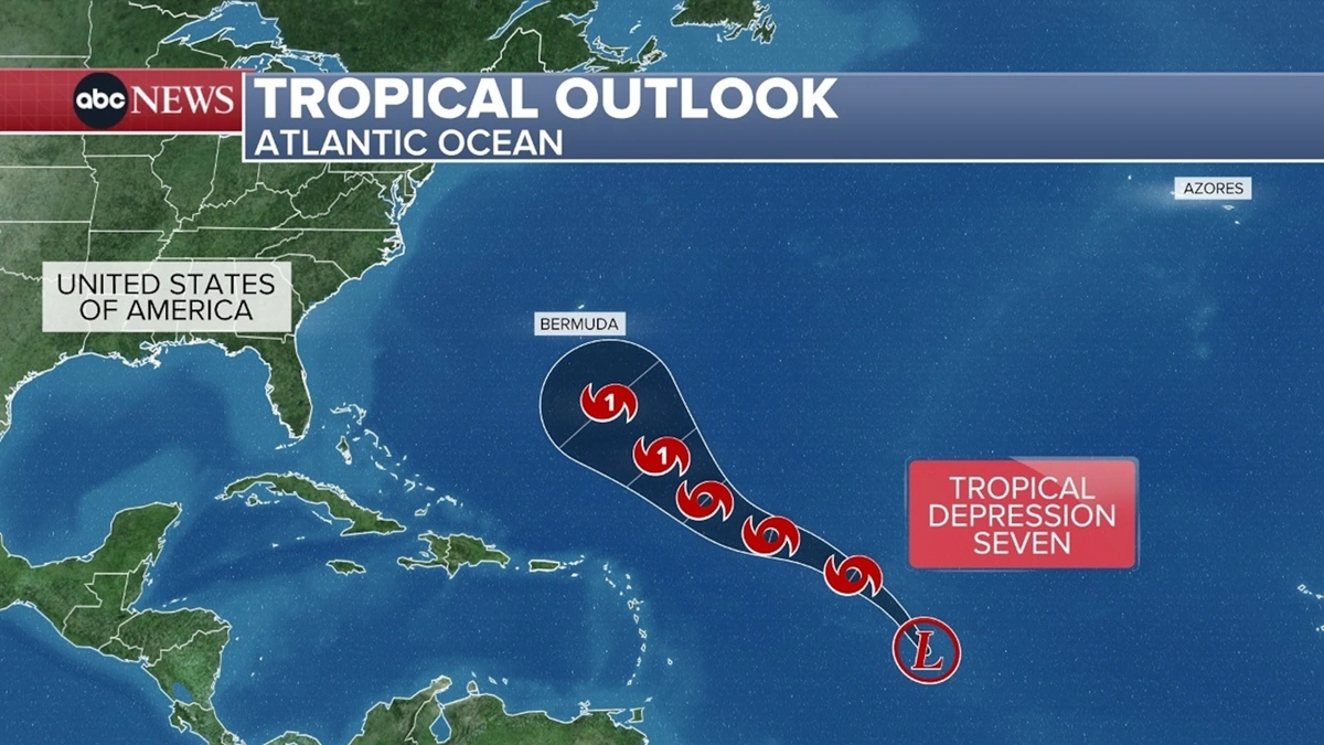
That infamous “cone of uncertainty”? It’s probably the most recognizable visual from the NHC. It shows the probable track of the storm’s center, but it’s important to understand what it doesn’t show. The cone represents the area where the storm’s center is forecast to be 68% of the time. That means there’s still a significant chance the storm could deviate outside the cone. A common mistake I see people make is thinking that if they’re outside the cone, they’re safe. The impacts of a hurricane – wind, rain, storm surge – can extend far beyond the cone itself. Storm surge, in particular, can be devastating, and its effects are often localized and difficult to predict precisely. Understanding hurricane preparedness is essential, regardless of whether you are inside or outside of the cone. According to the NHC, storm surge is often the greatest threat to life during a hurricane.
Decoding the Jargon | From Knots to Millibars
Okay, let’s break down some of the jargon. Hurricane wind speed is measured in knots (nautical miles per hour). A knot is about 1.15 miles per hour. So, when they say a hurricane has winds of 80 knots, that’s roughly 92 mph. Central pressure is measured in millibars (mb). The lower the pressure, the stronger the storm. A Category 5 hurricane typically has a central pressure below 920 mb. And then there are the different categories of hurricanes – from Category 1 (winds of 74-95 mph) to Category 5 (winds of 157 mph or higher). Each category represents a different level of potential damage. But, honestly, even a Category 1 hurricane can cause significant damage, especially from flooding and storm surge.
Hurricane tracking models are another source of information that the NHC uses to help the public understand the potential path a hurricane could take. What fascinates me is the sheer computing power required to run these models. The NHC uses a variety of models, each with its own strengths and weaknesses. Some models are better at predicting the track, while others are better at predicting the intensity. The NHC forecasters consider all of these models when making their official forecasts.
Why Evacuation Orders Are So Crucial
When an evacuation order is issued, it’s not a suggestion – it’s a directive. Local authorities make these decisions based on the NHC’s forecasts and their own assessments of the potential risks. A big problem is, people often hesitate to evacuate, thinking they can ride out the storm. That’s a risky gamble. Storm surge can inundate areas miles inland, and even if your home is strong, you could be cut off from emergency services.Link 2And let’s be real, no one wants to be stuck in the middle of a hurricane without power, water, or a way to communicate. Always heed evacuation orders – it’s better to be safe than sorry. It is important to have a hurricane evacuation plan in place before the storm arrives. This plan should include where you will go, how you will get there, and what you will bring with you.
Staying Informed and Staying Safe | Your Action Plan
So, what can you do to stay informed and stay safe during hurricane season? First, bookmark the NHC’s website (nhc.noaa.gov). Check it regularly for the latest forecasts and warnings. Sign up for local alerts from your emergency management agency. Have a hurricane safety kit prepared with essential supplies like water, food, medications, and a first-aid kit. Review your insurance policies to ensure you have adequate coverage for flood damage. And most importantly, have a plan. Know where you’ll go if you need to evacuate, and make sure your family knows the plan too.
Here’s the thing: preparation is key. Don’t wait until a storm is bearing down on you to start thinking about what to do. Take action now, and you’ll be much better prepared to face whatever comes your way. A recent study by the National Oceanic and Atmospheric Administration (NOAA) found that communities with strong preparedness plans experience significantly less damage and fewer casualties during hurricanes.
FAQ | Your Hurricane Questions Answered
What’s the difference between a hurricane watch and a hurricane warning?
A hurricane watch means that hurricane conditions are possible in the specified area, usually within 48 hours. A hurricane warning means that hurricane conditions are expected in the specified area, usually within 36 hours.
How does the Saffir-Simpson Hurricane Wind Scale work?
The Saffir-Simpson Hurricane Wind Scale classifies hurricanes based on their sustained wind speeds. It ranges from Category 1 (74-95 mph) to Category 5 (157 mph or higher), with each category representing a different level of potential damage.
What is storm surge, and why is it so dangerous?
Storm surge is the abnormal rise in sea level during a hurricane or other intense storm. It’s caused by the storm’s winds pushing water towards the shore. Storm surge is often the greatest threat to life and property during a hurricane, as it can inundate low-lying areas and cause widespread flooding. Storm surge flooding can cause extensive damage to homes and businesses.
Where can I find reliable information about hurricane preparedness?
The National Hurricane Center (nhc.noaa.gov) and your local emergency management agency are excellent sources of information about hurricane preparedness.
Ultimately, the National Hurricane Center exists so that we can survive. They distill complexity into actionable information, and they do so with incredible dedication. Taking the time to understand their work isn’t just about intellectual curiosity; it’s about empowering yourself to protect what matters most.

